Oldal 2 [2]
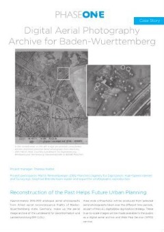
Historical aerial photographs allow a reconstruction of
the past and can therefore provide important information
for future planning processes. One application for such
photographs is with real estate planners who are required
to use historical aerial images to identify potential
unexploded bombs left behind from World War II. Among
the many other possible applications is the analysis of
changes in land use over the decades, e.g. with regard to
road and settlement development.
High Resolution and Accuracy, High
Speed, and Minimum Distortion
High-resolution digitization of the individual aerial
photographs preserves all the information and fine detail
in the analogue images needed in order to generate
orthophotos. LGL already had scanners specifically
designed for aerial image digitization, with radiometric
characteristics and resolutions that met the digitization
requirements. Although, their current system reaches the
required image accuracy, it takes around nine minutes per
scan. The 300,000 collection of images would therefore
take close to a decade to complete and so it was inefficient
for the project. Expensive system maintenance was also a
consideration with a service level agreement costing tens
of thousands of Euros.
Theresa Herbst, Project manager, had to find a more
efficient alternative in order to implement the project.
Together with Martin Riemensperger from the LDBV
preliminary considerations lead to the conclusion that a
system with a minimum resolution of 1100 dpi needed to
be acquired. Furthermore, the new imaging system had to
ensure a digitization process with minimum distortion and
highest repeat accuracy.
ONE
For more information, please visit
www.phaseone.com/cultural-heritage
Follow us on
Facebook @phaseoneindustrial
LinkedIn company/phase-one-ch
YouTube youtube.com/c/PhaseOnelndustrial
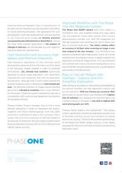
Improved Workflow with The Phase
One 150 Megapixel Camera
The Phase One 150MP camera with Linos inspec.x L
4.0/100mm lens, and modified Phase One copy stand
was the preferred choice after several other camera
demonstrations and test runs. With 150 megapixels, the
1100 dpi resolution was confirmed not only in theory but
also in practical application. The metric camera offers
an accuracy of 22.5um when scanning an image in one
shot instead of the nine minutes. The 4.0/100mm lens
ensures consistently high image quality. Due to its 1:5 scale
and distortion-free display, this lens is ideally suited for the
digitization of the aerial image archive. The copy stand and
lens are fixed with screws and cannot be adjusted, so as to
ensure that the required repeat accuracy is guaranteed as
well as easy to handle solution.
Easy to Use yet Robust User¬
interface - Capture One CH ¬
Simplifies Digitization
After setting up, providing on-site training, and establishing
the optimal workflow, the new digitization solution was
put into operation. With two Frames per second at 16bit
and its easy to use yet robust user-interface with Capture
One CH software, the Landesamt für Geoinformation und
Landentwicklung in Stuttgart is now able to digitize 500
aerial photographs per shift.
Theresa Herbst makes a first assessment: “The camera
solution significantly simplifies the digitization process. Due
to the faster workflow, we can now transform our analog
archive very quickly.” Thanks to the pioneering technology
of the Phase One 15O0MP camera, the LGL is now ideally
equipped for the future and looks forward to all upcoming
digitization tasks.