
Oldal 1 [1]
OCR
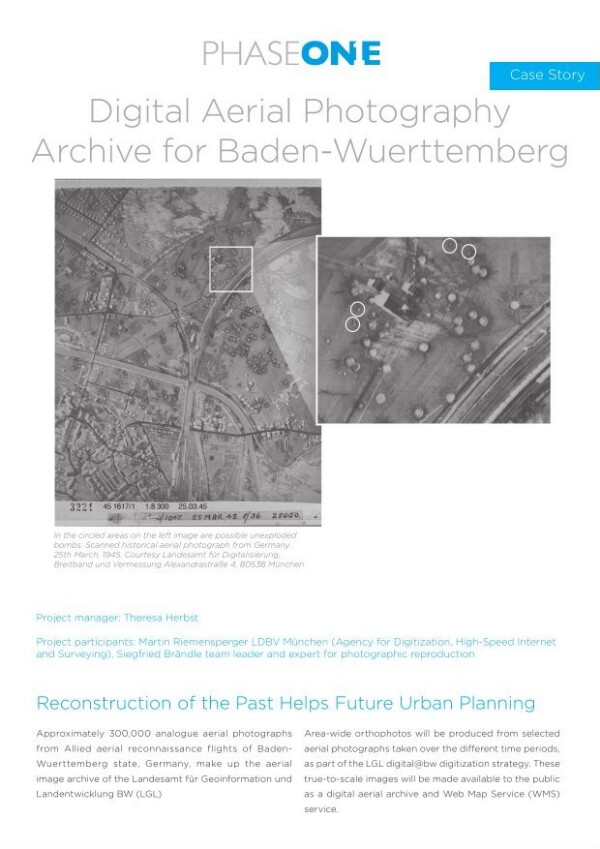
PHASE Digital Aerial Photography Archive for Baden-Wuerttemberg Approximately 300,000 analogue aerial photographs Area-wide orthophotos will be produced from selected from Allied aerial reconnaissance flights of Baden- aerial photographs taken over the different time periods, Wuerttemberg state, Germany, make up the aerial as part of the LGL digital@bw digitization strategy. These image archive of the Landesamt fur Geoinformation und true-to-scale images will be made available to the public Landentwicklung BW (LGL) as a digital aerial archive and Web Map Service (WMS) service.